Crayonbird
Menu

Geography · Ages 7–9 · 50 minutes

The seven continents and five oceans

Children name and locate the world's seven continents and five oceans on a world map and a globe, and say which continent they live on.

Success criteria

  • I can name the seven continents
  • I can name the five oceans
  • I can find them on a map and a globe

Key vocabulary

  • continent
  • ocean
  • globe
  • world map
  • equator
  • Africa
  • Antarctica
  • Asia
  • Australia
  • Europe
  • North America
  • South America
  • Arctic
  • Atlantic
  • Indian
  • Pacific
  • Southern

You will need

  • an inflatable globe or classroom globe
  • large outline world maps
  • coloured pencils
  • continent name cards
  • blue sticky notes

Practice sheets

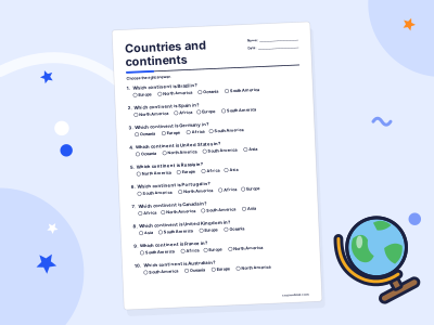
Generated fresh each time you press a button, and marked instantly on screen.

The lesson at a glance

50 minutes in all. Timings are a guide: follow your class.

  1. Step 1: Starter

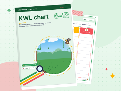
    Hand out the KWL chart from the practice buttons (or draw one on the board).
    8 minutes
  2. Step 2: Teach

    Show the globe and a flat world map side by side.
    10–15 min
  3. Step 3: Guided practice

    Play "Catch the globe".
    15 minutes
  4. Step 4: Independent practice

    Each child colours an outline world map: each continent a different colour, all oceans blue, with labels.
  5. Step 5: Plenary

    Hold up a picture of an animal (a penguin, a kangaroo, a camel, an elephant) and ask children to name a continent where it lives in the wild.
  6. Step 6: Assessment for learning

    Can children name all seven continents and five oceans?
  7. Step 7: Differentiation

    Support: work with a map that already has the first letter of each continent, and focus on four continents and two oceans first.
  8. Step 8: Common misconceptions

    "Africa is a country." It is a continent with more than fifty countries.
  9. Step 9: Home link

    Look at a globe, a world map or a map app together and find the continent and ocean closest to where you live.

Children see world maps all the time, but the big shapes rarely get a name. This lesson gives them the seven continents and the five oceans through a chant, a map and a globe-throwing game, and finishes with the most important one: where we are.

1.Starter

8 minutes

Hand out the KWL chart from the practice buttons (or draw one on the board). In the first column, children write or draw everything they already know about the world: countries, seas, animals, places they have been or have family. In the second, one thing they want to find out. Eight minutes.

2.Teach

10–15 min

Show the globe and a flat world map side by side. "A globe is a model of the Earth. A map is a flat picture of it. Most of the Earth is covered by water."

Point out the big pieces of land: "These huge pieces of land are called continents. There are seven." Name them as you point: Africa, Antarctica, Asia, Australia (some books call this region Oceania), Europe, North America, South America.

Then the oceans: "The huge areas of salt water between them are oceans. There are five: the Pacific, the Atlantic, the Indian, the Southern and the Arctic Ocean."

Teach a quick chant with actions, for example tapping your knees for each continent and waving for each ocean, and say it twice together. Then ask: "Which continent do we live on? Which is the biggest? Which is the coldest?"

  • globe
  • map
  • whale
  • penguin
  • elephant
  • camel
A globe, a map and animals from three different continents.

The rest of the plan

Guided and independent practice, the plenary, assessment for learning, differentiation, common misconceptions and the home link are free with a Crayonbird account.

  1. Guided practice15 minutes
  2. Independent practice
  3. Plenary
  4. Assessment for learning
  5. Differentiation
  6. Common misconceptions
  7. Home link

Learning Wiki

Continents

Continents are the very large areas of land on Earth. In English-speaking schools you usually learn seven, but some countries count six.

Oceans

Oceans are the huge bodies of salt water that cover most of Earth. There are five: the Pacific, Atlantic, Indian, Southern and Arctic.

Countries

A country is an area of land with its own borders, government and laws. Most lists count 195 countries in the world today.

  • Geography · Ages 7–9 · 55 min

    Map skills and compass directions

    Children use the four compass points to give and follow directions on a grid map, and read simple map symbols with a key.

  • Geography · Ages 8–11 · 60 min

    How volcanoes work

    Children label the main parts of a volcano, explain that magma rises from deep inside the Earth and erupts as lava, ash and gas, and locate some well-known volcanoes on a world map.

  • Study skills · Ages 7–9 · 50 min

    Algorithms without a computer

    Children write a clear, ordered set of instructions (an algorithm) to complete a task, test it, and debug it when it goes wrong.